Honolulu International Airport (HNL)
Driving Directions / Travel by Car
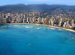
(Honolulu, Hawaii - HI, USA)
As the main airport in Hawaii, Honolulu International Airport (HNL) is well served by road, with the main Nimitz Highway and the Queen Liliuokalani Freeway of I-H1 interstate (Lunalilio Freeway / Queen Liliokalani Freeway) running right past the facility, off the I-201 interstate (Moanalua Freeway).
Located on Oahu's southwestern coast and next to Keehi Lagoon and Mamala Bay, Honolulu Airport is accessed via Aolele Street, off Puuloa Road.
Areas of interest close to Honolulu Airport include Pearl Harbor, Pearl City and Waipauu, all of which are situated to the northwest. To the south, the Mamala Bay Golf Course is a popular distraction for those with delays or long waits, while the nearby Keehli Lagoon Beach Park is also worth considering, to the northeast.
Directions to Honolulu International Airport (HNL) from the north:
- Head south along H3 and H1
- Exit the H1 at Exit 16 onto Service Road A and follow the signs for the airport
Directions to Honolulu International Airport (HNL) from the east:
- Take the Queen Liliuokalani Freeway of I-H1 east
- Take the Exit 16 onto Service Road A and follow the signs for Honolulu Airport
- From downtown Honolulu, take the Nimitz Highway all the way to the terminals
Directions to Honolulu International Airport (HNL) from the west:
- Take the H1 east and south, past Pearl Harbor
- Take the Exit 16 onto Service Road A and follow the signs for the airport
The Nimitz Highway and Queen Liliuokalani Freeway of I-H1 are the main roads feeding the airport and the rest of the island, and as a result they are busy throughout the day.
Honolulu International Airport (HNL): Virtual Google Maps
