Honolulu International Airport (HNL)
Orientation and Maps
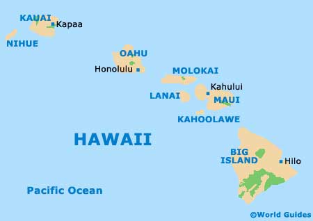
(Honolulu, Hawaii (HI), USA)
Hawaii's most famous city, Honolulu is located on Oahu, the country's most developed island. A modern city full of high-rise coastal hotels, glorious sandy beaches and landscaped parklands, Honolulu is the ultimate holiday destination.
One of the most popular ways to reach the city is via Honolulu International Airport (HNL), located on the northwestern side of the city and next to Keehi Lagoon. Getting around the island is best by rental car or bus, although many people also choose to hire mopeds. Honolulu's bus network is excellent and offers extensive coverage of most of Oahu, being operated by 'TheBus' and featuring around 80 different routes. Free route maps are available, showing all of the routes and stops.
Honolulu International Airport (HNL) Maps: Important City Districts
One of Honolulu's most famous beach suburbs is the Waikiki area, which is a major tourist hotspot, full of hotels, restaurants and other amenities. Waikiki has plenty to offer, including stunning beaches, great surfing conditions and breathtaking views.
The main center of Honolulu is the downtown area, which is home to a true mixture of old and new. A number of important historical buildings stand in this part of the city, alongside modern skyscrapers in the bustling Central Business District. The nearby Chinatown area is particularly appealing and amongst the best in the whole of America, featuring outdoor markets and plenty of places to eat.
A great way to make the most out of your visit to this part of Hawaii is to pick up a copy of the 'Honolulu Weekly', which contains comprehensive details of what's on in and around the city.
USA Map

Hawaii Islands Map
Honolulu Map

